 ES
 CAT
Technology solutions
Discover our customised tools to make your management easier.
Discover our customised tools to make your management easier.
Manage your resources from any device in the simplest way.
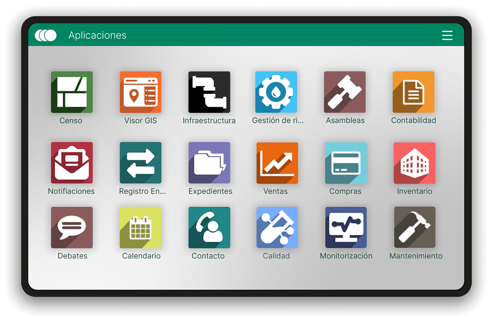
Control all your resources from a single tool.
Control all your resources from a single tool.
Multi-platform
We want to give you the flexibility to work efficiently from any device. Managing your business is always within reach, wherever you are.
01
Multi-platform
We want to give you the flexibility to work efficiently from any device. Managing your business is always within reach, wherever you are.
01
Financial expenses
With Moval, you can track your invoices, manage your budgets and have a clear view of your finances, all in one place. Forget the chaos and enjoy calmer, more efficient financial management.

02
Inventory control
Tracking inflows and outflows in detail and optimising your stock levels has never been easier. Keep your inventory under control and make informed decisions with the confidence Moval gives you.
03
Take advantage of the capabilities of our GIS Viewer:
Take advantage of the capabilities
of our GIS Viewer:
Technical Mode
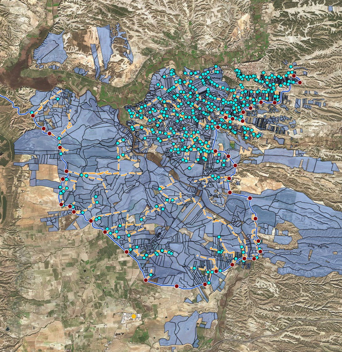
The viewer is a versatile tool that offers base maps to analyse how areas have changed over time through aerial and satellite images. It allows you to work with orthophotos or simplified representations, classify by sector and draw sketches for field studies. It also includes geolocation and tools for quick linear or area measurement.
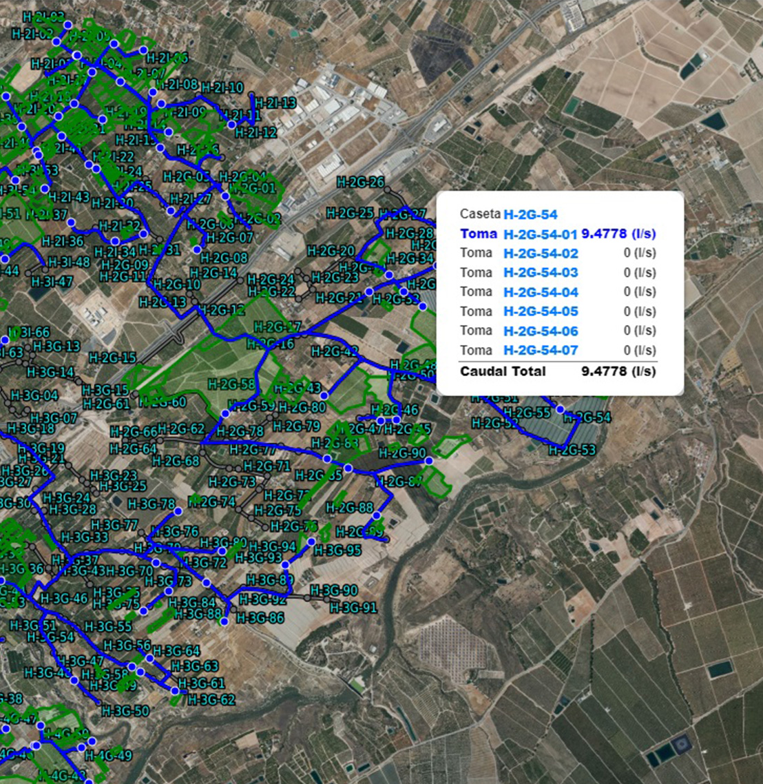
Remote Control Mode
Remote Control mode lets you view the infrastructure in operation in real time, from individual meters to large pumping stations. It is accessible from any location and lets you query key variables and relationships in the database, such as Hydrant-Plot-User, to know who is irrigating at any given moment.
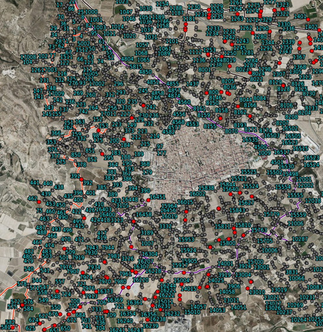
Meter Reading Mode
Meter Reading mode lets you record meter readings easily, eliminating manual data transfer. The viewer acts as a SCADA, where operators can geolocate the meter, check the reading history and update the information in real time. In addition, thematic visualisations are configured to easily identify the meters whose readings have been taken.
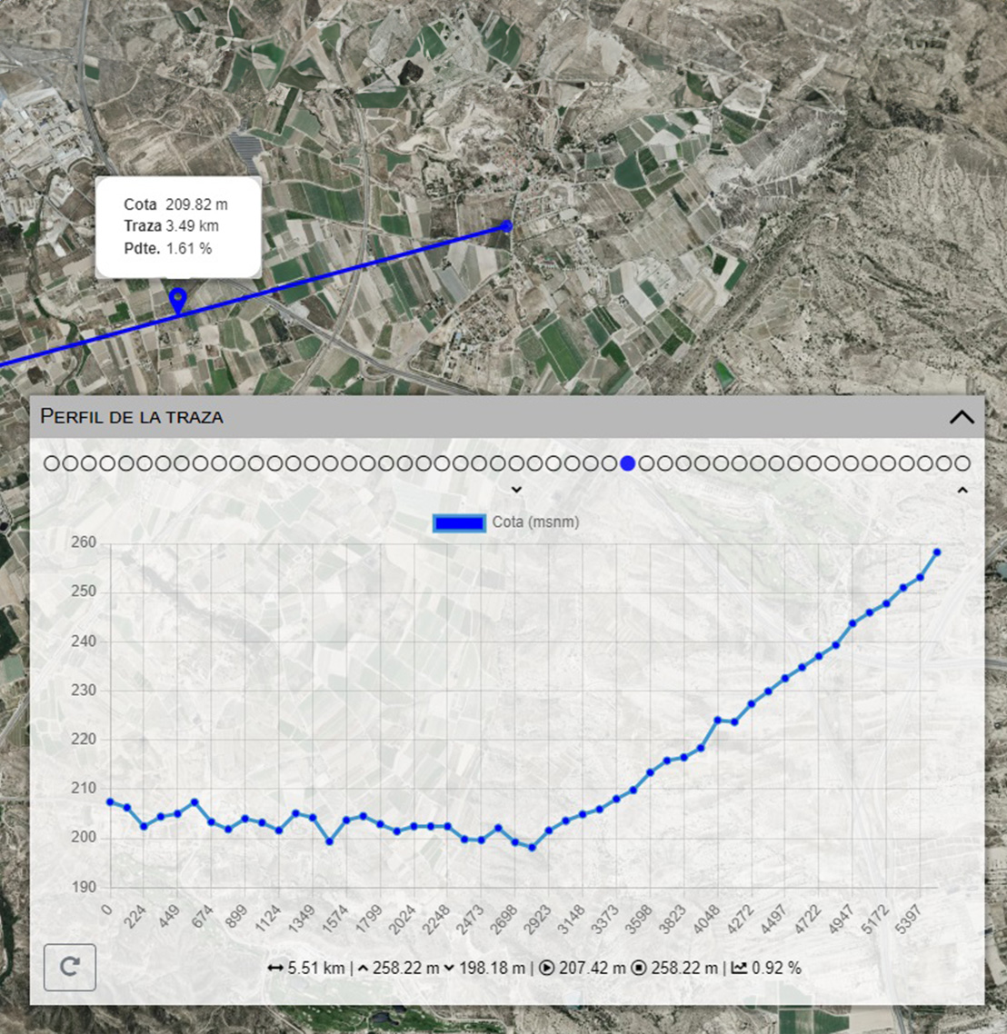
Terrain Elevation Mode
This mode lets you use the Viewer to create topographic profiles based on Digital Terrain Models with 2-metre accuracy, or to query the elevation of a specific point using Individual Points or Profile Tracing. It is useful for planning investments or actions in irrigable areas by knowing height differences and geometric altitudes precisely.
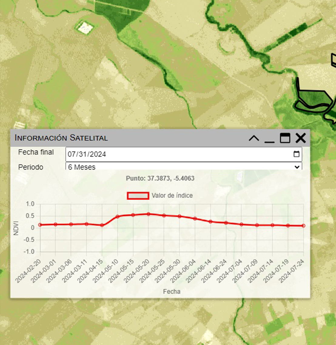
Remote Sensing Mode
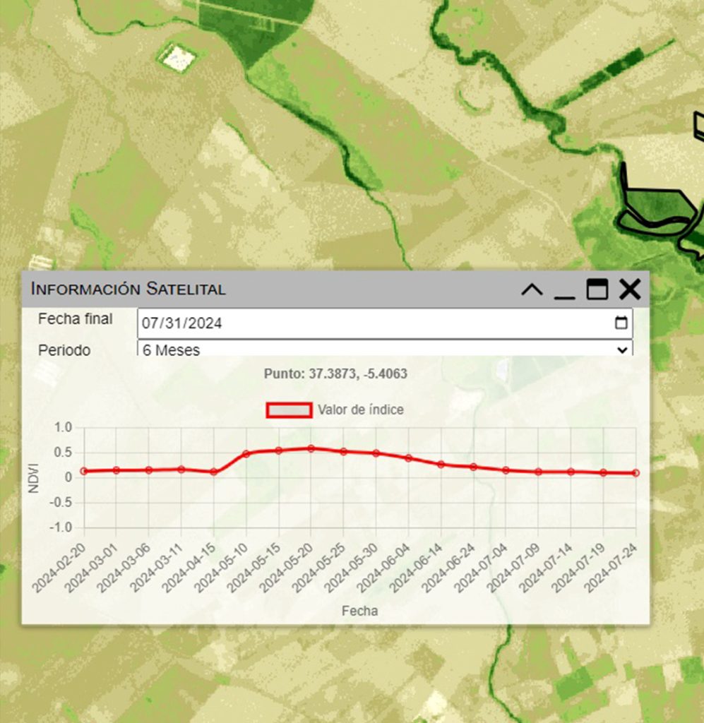
Remote Sensing mode uses the NDVI (Normalized Difference Vegetation Index) to assess vegetation health from satellite images. It lets you monitor crop growth, detect water stress or disease early, and optimise irrigation and fertilisation by identifying areas with different vegetation vigour indices, enabling a fast and accurate response from farmers.
Technical Mode
The viewer is a versatile tool with several functions that are useful day to day.
It offers a broad repository of base maps that let you see how an area or plot has changed over time, providing aerial images from the earliest topographic flights to the most recent satellite images.
It also lets you choose between different modes, such as orthophotos or simplified representations, depending on the needs of the job.
- It lets you classify by sector, canal, hydrant, whether they have been modernised or not, and so on, from the database we provide, with endless possibilities for thematic representation.
- Tools for drawing sketches in specific areas for field studies.
- Query locations with geolocation in different reference systems.
- Take a quick linear or area measurement with the measurement tools.
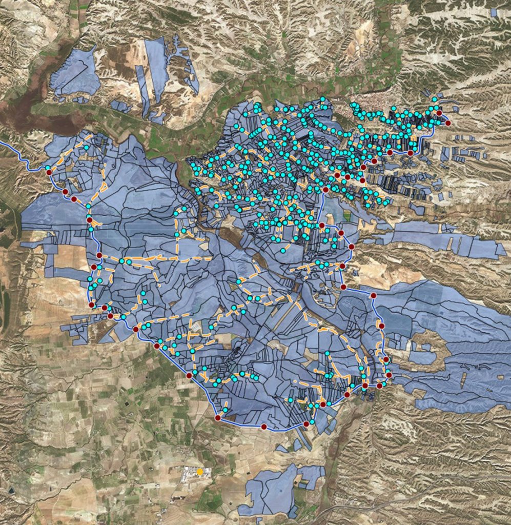
Remote Control Mode
Remote Control mode is used to view all the infrastructure in operation. It is a digital base that is easy to modify and always available from wherever the system operator is.
Through remote control mode it is possible to:
- View the infrastructure in operation in real time, whether individual meters or large pumping stations feeding the network or a reservoir, as well as, for example, accumulated levels and any operating variable that may be needed.
- Directly access the relationships available in the database, such as the Hydrant-Plot-User relationship, from which it would be possible to know who is irrigating at any given moment.
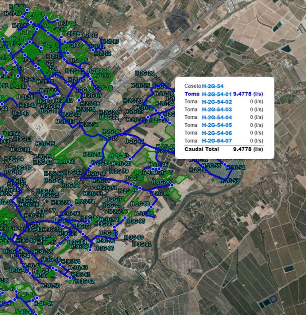
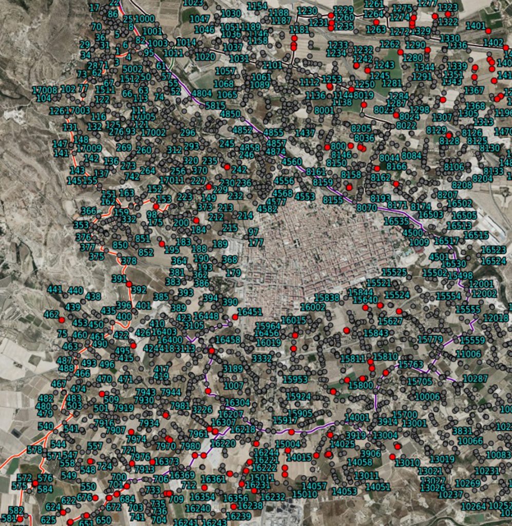
Meter Reading Mode
If you have a distribution network without remote meter reading, Meter Reading mode makes it possible to record readings easily as you go. The viewer is used as a large SCADA, always available to operators, so they can note the reading directly in the tool and the information is transferred to the management system. Thanks to this we can save a lot of time transferring information from one medium to another, as was traditionally done.
To locate the meter we can geolocate ourselves once we are at the site, and in the same tool we can check the history of previous readings. The display of the meters is configured with different themes so you can easily tell whether a reading has been taken, for example by changing the colour of meters that have a reading for the same period.
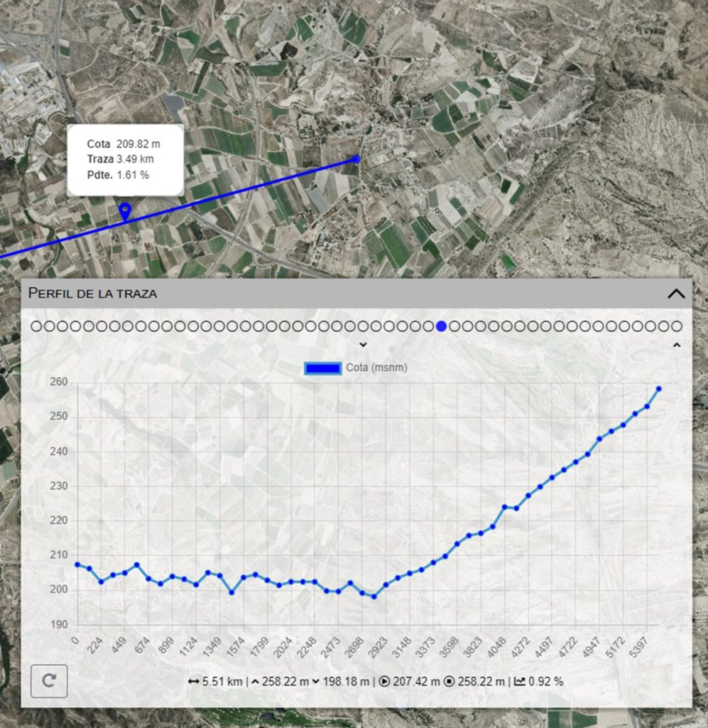
Terrain Elevation Mode
With this mode you can use the Viewer to create topographic profiles based on Digital Terrain Models with 2-metre accuracy, or query the elevation of a specific point using the two main options: Individual Points or Profile Tracing.
It is a very useful mode for studying subsequent actions or possible investments in the irrigable area, knowing height differences and geometric altitudes precisely and very easily.
Remote Sensing Mode
Remote Sensing mode uses the NDVI (Normalized Difference Vegetation Index) to assess the health and vigour of vegetation. It is based on the difference between the visible radiation and the near-infrared radiation reflected by plants, captured through satellite imagery.
Through the NDVI index it is possible to:
- Monitor crop growth, observing the stage of development.
- Early detection of water stress or disease: Drops in the NDVI value can point to problems in crops, such as lack of water, disease or pests, allowing a faster response from farmers.
- Optimise irrigation and fertilisation: by identifying zones or sectors with different indices.
Some of our
tools currently:
Some of our
tools currently:
01
Moval Regadío
Moval Regadío
Moval Regadío is the first tool that we developed and implemented Moval. It is a tool specifically for Irrigation Communities and other water resources management.
bodies. In addition to the modules common to all the tools, Moval Regadío it can incorporate specific modules for these bodies, such as, among others:
• GIS Parcel Viewer
• Water Quality Control Module
• General Meeting Organisation Module
• Maintenance Module
• Quota Module
• Infrastructure Module
Moval Montes
Moval Montes
02
Moval Montes is our most recently created tool, for the management of Forestry Associations and other management of the national forest heritage.
It provides the tools for the proper management of the territory, linking plots with owners, heirs and users, in order to enhance the value of forest heritage. Among others, it includes the following core modules:
• GIS Viewer
• Territorial Base Module
• Module specific to each Association and Province
03
Moval PYME
Moval PYME
Moval PYME is the tool for the Moval management of Small and Medium-sized Enterprises. It is a complete ERP that helps with proper financial and document management, of inventories and of bank transactions.
Moval PYME it can incorporate specific modules for this type of organisation, such as, among others:
• Sales Module
• Invoicing and Accounting Module
• Purchasing Module
• Manufacturing Module
• Inventory Module
• Employees
Moval Balsas
Moval Balsas
04
Moval Balsas was created as a tool intended for administration, for the document and cartographic management of the reservoirs scattered across the national territory.
Currently our water storage infrastructure management system is deployed in the Region of Murcia, where it holds the information on all the existing reservoirs in the region. It has been used successfully to identify and contact the owners of different classes of reservoirs in order to encourage their documentary regularisation, as regards classification proposals and emergency plans .
05
Moval Agro
Moval Agro
Moval Agro is the tool for the Moval for the complete management of Farms of all sizes. It is a complete system for the economic and technical management of the infrastructure, which can include specific modules for this type of organisation, such as, among others:
• Territory Module
• Infrastructure Module
• Energy Monitoring Module
• Production Module
Moval Origen
Moval Origen
06
Moval Origen is the tool for the Moval management of Protected Geographical Indications and Protected Designations of Origin. This tool adapts to each organisation according to the control needs they have:
• Parcel Census Module
• Quality Module
• Weighing Module
• Warehouse Module
• Certificate Issuing Module
07
Moval Innova
Moval Innova
Moval Innova is our tool adapted to the execution of research and development projects. It is a tool capable of adapting completely to projects according to their needs:
• GIS Viewer
• Survey Module
• Analytics Module
• Custom Modules
Try one of our
demo instances.
Try one of our
demo instances.
User: demo
Password: demo_Moval
Full
This demo instance includes most of the modules (some modules are incompatible with each other), including those for Accounting, Grafana, Quotas, Energy Efficiency, General Meetings, Website, etc.
Empty
In this instance, only one member and one plot have been created. This instance has write permissions, so you can create, delete or edit any item within the instance.
Moval Wiki
Frequently asked questions
These are some of the most frequent questions we receive from users when they start getting to know the tool; we hope they can help you:
Yes. With our modular and scalable ERP you can cover all of your organisation’s processes, from employee management to accounting and invoicing, including energy monitoring or infrastructure control. There are more than 20,000 modules to adapt to the reality of your organisation.
Yes. And if it doesn’t exist, we create it.
We take care of the implementation, installation, configuration and training, and we also import all the relevant information from your previous databases.
Once the system implementation is complete, users are given a dedicated support email address to handle queries about their instance. In addition, if you have an urgent matter you can always call us by phone, and we’ll be on the other end to answer your questions.
Yes. All our years of experience and knowledge have been gathered in a public Wiki so that users can access explanations of their work processes and descriptions of each module. Here is the link.
Yes. Our ERP also allows you to install multi-company modules in order to cover more than one entity within the same instance.
We have several options for data storage, from locations on our own servers to servers set up on the client’s own premises or cloud solutions. It all depends on your needs, with no restrictions.
Implementing a Moval ERP in your organisation means Moval becomes part of your team. Behind every instance there is a team of technicians from a wide range of fields: lawyers, administrators, geographers, IT specialists, engineers, surveyors, draughtspeople…
We can help you with whatever you set out to do.
Because of the modular nature of our solutions there is no single price. Get in touch with us to receive a personalised quote.